
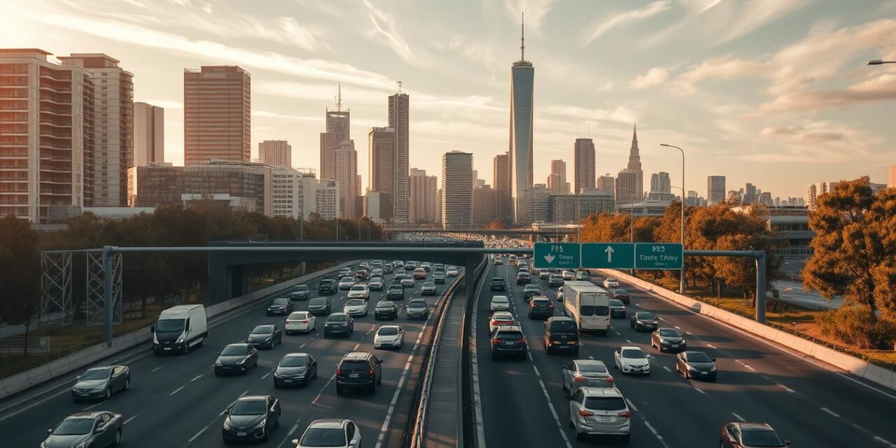
Stretching across Melbourne’s south-east, this major arterial road serves as a critical transport link for thousands of Victorians daily. It connects the bustling CBD with sprawling suburban areas and extends further to regional destinations.
Carrying up to 180,000 vehicles every day, this route ranks among Australia’s busiest transport corridors. The constant flow of traffic demonstrates its essential role in keeping Melbourne moving.
Designated as M1 along its entire 34-kilometre length, the roadway honours General Sir John Monash, one of Australia’s most respected historical figures. His legacy lives on through this engineering marvel.
The route integrates seamlessly with other major roads including CityLink and West Gate Freeway. This network integration significantly reduces travel times across the metropolitan area.
Key Takeaways
- The Monash Freeway connects Melbourne’s CBD to south-eastern suburbs and Gippsland
- It carries approximately 180,000 vehicles daily, making it extremely busy
- The entire route bears the M1 designation
- It was named in honour of General Sir John Monash
- The freeway spans 34 kilometres from Kooyong to Narre Warren
- It connects with other major routes like CityLink and West Gate Freeway
- The roadway significantly reduces congestion in Melbourne’s south-east
The Historical Evolution of Monash Freeway
Melbourne’s vital transport corridor began as two separate road projects that would eventually merge into one continuous route. This piecemeal development approach reflected the growing needs of Melbourne’s expanding south-eastern suburbs.
Origins as Mulgrave Freeway and South Eastern Freeway
The current roadway originated from two distinct transport routes. The Mulgrave Freeway served as Freeway Route 81, stretching from Warrigal Road in Chadstone to Princes Highway in Eumemmerring.
Meanwhile, the South Eastern Freeway operated as Metropolitan Route 80, later becoming Freeway Route 80. This section ran from Punt Road in Richmond to Toorak Road in Hawthorn East.
These separate projects addressed different transportation needs before their eventual integration.
Key Milestones in Construction and Integration
The Mulgrave Freeway construction occurred in stages between 1972 and 1981. The first section opened in 1972, connecting Princes Highway to Stud Road.
Progress continued with the Stud Road to Springvale Road segment completing in 1974. The final western extension reached Warrigal Road by 1981.
The South Eastern Freeway development started earlier, with its initial section opening in 1962. This connected Swan Street to Burnley, with extensions reaching Toorak Road by 1970.
Transport Minister Rupert Hamer played a significant role in these developments. His vision helped shape Melbourne’s growing road network.
| Year | Project Section | Distance Covered |
|---|---|---|
| 1962 | South Eastern Freeway (initial) | Swan Street to Burnley |
| 1970 | South Eastern Freeway extension | To Toorak Road |
| 1972 | Mulgrave Freeway (first section) | Princes Highway to Stud Road |
| 1974 | Mulgrave Freeway extension | Stud Road to Springvale Road |
| 1981 | Mulgrave Freeway completion | To Warrigal Road |
The critical integration came with the South Eastern Arterial project in 1988. This connected Toorak Road to Warrigal Road, bridging the gap between the two freeways.
Initially, this arterial link faced congestion issues due to at-grade intersections. These traffic problems prompted further upgrades to proper freeway standards.
Major improvements included overpasses at Warrigal Road completed in 1994. Additional underpasses at Toorak and Burke Roads followed, transforming the arterial into a full freeway by 1997.
The Country Roads Board and Melbourne & Metropolitan Board of Works managed early construction. Responsibility transferred to VicRoads in 2004 under the Road Management Act.
This evolution aligned with the 1969 Melbourne Transportation Plan’s vision. The plan anticipated connections that projects like CityLink would later realise.
Monash Freeway’s Role in Traffic and Economic Infrastructure
Moving both people and goods efficiently, this transport route serves as an economic lifeline for the growing south-eastern region. Its strategic importance extends beyond mere transportation to encompass broader economic and social benefits.
Daily Traffic Volume and Connectivity Impact
This vital corridor handles approximately 180,000 vehicles every day. Such immense volume makes it one of Australia’s busiest transport routes.
Under ideal conditions, the journey from Clyde Road to Kings Way takes about 32 minutes. Peak periods dramatically increase travel times to 45-70 minutes.
Accidents or major incidents can extend trips to 110 minutes or longer. These variations highlight the route’s sensitivity to disruptions.
The roadway connects through major interchanges including EastLink and South Gippsland Freeway. These connections provide seamless access to suburbs like Dandenong and Berwick.
VicRoads’ advanced Traffic Management System optimises flow using ramp metering and electronic signs. This technology helps maintain safety and reduce congestion during busy periods.

Economic Benefits to Melbourne’s South-East
The transport corridor significantly supports logistics and commercial activities across south-eastern industrial zones. Businesses benefit from reduced freight costs and improved supply chain efficiency.
Improved access to employment centres has stimulated growth in areas like Narre Warren. The population expansion in Melbourne’s south-east relies heavily on this infrastructure.
Regional development benefits from the integration with other transport routes. Trips to Gippsland become more efficient, reducing reliance on alternative roads like Princes Highway.
| Travel Scenario | Time from Clyde Road to Kings Way | Conditions |
|---|---|---|
| Standard Travel | 32 minutes | Ideal conditions, normal traffic |
| Peak Period | 45-70 minutes | Morning/evening rush hours |
| Major Incident | 110+ minutes | Accidents or significant disruptions |
The additional lanes implemented through various upgrade projects have increased capacity significantly. These improvements help manage the heavy daily traffic more effectively.
Economic analysts note the corridor’s role in supporting Melbourne’s overall growth strategy. The infrastructure investment continues yielding returns through enhanced regional connectivity.
Major Upgrade Projects Enhancing Monash Freeway
Multi-phase improvement works have modernised Melbourne’s key south-eastern transport artery. These strategic enhancements addressed growing congestion while incorporating advanced technology and sustainable practices.
Stage 1: Lane Expansions and Initial Improvements
The initial upgrade phase ran from 2016 to 2018. This critical construction project added 30 kilometres of new lanes along the corridor.
Widening works transformed sections from four to five lanes between EastLink and South Gippsland Freeway. Beyond this point, capacity increased from two to three lanes extending to Clyde Road.
Fulton Hogan delivered this ambitious monash freeway upgrade in partnership with VicRoads. The team utilised 180,000 tonnes of asphalt and widened eight pairs of bridges.
Completion occurred 11 weeks ahead of schedule, generating significant economic benefits.
“The early finish saved approximately A$21 million in broader economic impacts and A$6 million in freight costs”
The A$230 million investment immediately improved traffic flow. This successful freeway upgrade set the foundation for subsequent enhancement works.
Stage 2: Advanced Technology and Additional Lanes
Building on initial successes, Stage 2 operated between 2020 and 2022. This phase added 36 kilometres of additional lanes across strategic sections.
Key improvements included new outbound lanes between Warrigal Road and EastLink. Inbound capacity increased between EastLink and Springvale Road, plus extensions from Clyde Road to Cardinia Road.
The project incorporated smart technology systems for optimal traffic management. Intelligent Transport Systems (ITS) and electronic gantries now monitor and guide vehicles efficiently.
Specific interchange enhancements transformed critical connection points. New ramps at Police Road and direct access from Jacksons Road to EastLink improved regional connectivity.
The Beaconsfield interchange received diamond-grade upgrades while O’Shea Road extension improved local access. These works formed part of the comprehensive freeway upgrade strategy.
Environmental initiatives demonstrated commitment to sustainable construction practices. Contractors used 70,000 tonnes of recycled concrete and Green Pipe material from recycled plastic.
Community engagement included artistic features like the Sweeney Drive mural. The total investment reached $1.08 billion, delivering reduced congestion and improved travel times.
Advanced monitoring systems now enhance safety across the upgraded corridor. This represents Melbourne’s most significant transport infrastructure achievement in recent years.
Conclusion
Melbourne’s vital south-eastern transport artery stands as a model of urban planning excellence. It has evolved from separate routes into a seamless, high-capacity corridor.
This infrastructure handles enormous daily traffic volumes while supporting regional economic growth. Recent upgrade projects have added vital lanes and smart technology systems.
Key interchange improvements at locations like Warrigal Road enhance connectivity across Melbourne’s network. These roads and ramps ensure efficient movement throughout the region.
The corridor demonstrates how strategic infrastructure investment balances capacity with sustainability. It remains essential for Melbourne’s continued growth and development.


